Pages

vendredi 29 novembre 2013

Makatea, a mining island


Above the Pacific Ocean

Makatea, an island of the Tuamotu, gets a unique geological formation, an exceptional industrial destiny and the only train of Polynesian history.

This amazing island upsets all the clichéd images which may be in your mind about the French Polynesia.

Makatea, an inaccessible atoll…
Imagine an atoll which would rise to 100 meters above the Pacific Ocean, posed as a nest on impassable cliffs... Imagine outdated mining facilities, intact but totally deserted, full-size museum to the glory of the industrial era… Imagine a railroad track 7 km long placed on this tiny island of the Tuamotu…


Some pictures and some music of Makatea
If you get to imagine this, then you begin to get an idea of what’s Makatea island, Tuamotu Archipelago, French Polynesia…

Makatea, a geographical anomaly
From Polynesian origin, the word “makatea” means a type of raised atoll with in its center the remains of the former volcanic island.

Originally, therefore, Makatea is an atoll like the others. This is the birth of the volcano that gave the island of Tahiti which is the origin of the Atoll Makatea uprising. Then the natural erosion did the rest.

Integral part of the Tuamotu Archipelago, Makatea is the only island in French Polynesia of this geological kind.

Covering an area of 24 km2, it measures 7.5 km from north to south and 7 km in its widest point, the southern part of the island.

A map that says a lot about an island like no other
The special nature of the coral base exposed to the air causes a number of geological peculiarities.

Firstly impassable cliffs, unique in the whole Polynesia, peak between 60 and 100 meters high anyway. The coast offers no bay, no beach that allows the approaching of boats and thus, a fortiori, to berth.

What remains of Temao port, today.
In the center of the island, a vast plain located 80 meters. One beach on the east coast to the only village of the island: Moumu. In the northern part of the plateau, the mining village of Vaitepaua completely abandoned. And finally, on the West coast at the foot of the cliff, just in front of the single pass which allows to approach the island: the small port of Temao where you can still see the remains of the loading dam for transshipment of phosphate.

Makatea: story of an atoll like no other
In 1722, after discovering Easter Island, the Dutch explorer Jacob Roggeveen becomes the first Westerner to accost Makatea.

The island is so daunting with its high cliffs and lack of coves or bays for serene moorings that he does nothing more than to note the event and the geographical position of the atoll in his logbook. He calls it “Aurora”, which means “the island of recreation”.

Phosphate open pit mine of Makatea
During the 180 years that followed, Makatea named “Papa Tea” (White Rock) by the Polynesians, will hardly disturbed by many people, despite the considerable changes that transform the whole Polynesia. Thus, neither the evangelization nor the colonization will change something in the way of life of a few dozen families who are living in this strange as inaccessible land.

The fate of the island takes off in the early years of the 20th century with the exploitation of phosphate rocks, the deposit of which was discovered in 1860 by Captain Bonnet.

Therefore, nothing will ever be the same in Makatea… at least until 1966 when the phosphate mining finally ceased on the island.

From one end to the other of the island, the road (photo: Jan Erik Johnsen)

At the last census of Polynesian population (2007), there were 61 permanent inhabitants in Makatea.

Today, the island is visited by the schooner (passenger-cargo ship), and therefore it’s just supplied, twice a month, at most…


Wealth of an island like no other
Nevertheless, Makatea holds amazing wealths.

The coast (photo Jan Erik Johnsen)
Thus, plagued by natural erosion, the base of the island is full of caves, some of which aren’t even listed. Further, below sea level, others have never been visited. All feed the legends and strengthen the mysterious character of Makatea.

It is said as well as, in bygone days, pirates and Spanish galleons have hidden treasures there. Some were used as burial places for senior figures pre-European Polynesian societies. Hung aloft, their bodies were deposited by “pirimato”, legendary beings capable of flying to the most inaccessible places. Cave Ana tau i ra’i on the cliff Temao is still tapu*

In 1959, Yves Allégret shots a film on Makatea
On the other hand, it’s interesting to note that this strange atoll has aroused the interest of several filmmakers who have located their film action. Including “The ambitious”, Yves Allégret with Andrea Parisi, Richard Basehard and Gerard O’Brien, shot in 1959 largely on the atoll of Makatea itself.

Remains only to discover the amazing industrial adventure Makatea that for 60 years has been the main economic engine of the entire French Polynesia.

An article of Julien Gué
Translated from French by Monak

Glossary:
*Tapu: taboo

See also the Article Tahiti.tv, with a 5‘30”video made from exciting archive footage by following this link: http://www.tahiti.tv/makatea-lile-phosphate-permalink-1351-2373-6624.aspx. And of course our articles: “The railway station of Makatea” and  Makatea today”.


Copyright Julien Gué. Ask for the author’s agreement before any reproduction of the text or the images on Internet or traditional press.


vendredi 22 novembre 2013

L'atoll de Rangiroa


à la saison des pluies

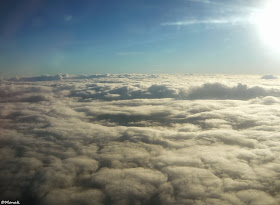
Il arrive que les Tuamotu fassent leur coquette et se dérobent au regard : les motu s’enveloppent de brume, l’horizon est bouché, se coconne de ouate fiévreuse. La saison des pluies astreint. De l’avion, aucune trace insulaire ne se devine : il flotte sur un plancher  floconneux, effleure une calotte aux allures de neige.

Un plancher nuageux en plaine neigeuse
Sous la barre nuageuse, Rangiroa laisse entrevoir son atoll festonné de hoa*, s’échancre sur la première passe de Tiputa qui ouvre le lagon à l’Océan Pacifique, se brouille sous un rideau de pluie. Le couchant n’est pas flamboyant, le lagon ne miroite pas mais joue tout de même ses camaïeux de bleus.

Spectre de motu  dans le crachin
Ciel couvert, gris… averse, crachin : comme toutes ses sœurs des Tuamotu, Rangiroa* aspergé, détrempé, gorgé, halitueux, fait ses provisions d’eau. Manne céleste particulièrement pure, consommable sur le vif. Son manque en sels minéraux doit être compensé pour un équilibre sanitaire, autrement, gare aux carences. Espérons qu’elle ne sera pas polluée… d’ici longtemps !

« Saison d’abondance »
Au programme du calendrier lunaire ma’ohi, la saison des pluies, enclavée d’octobre-novembre à mars-avril, légitime son appellation traditionnelle de « saison d’abondance » car elle ruisselle, s’inonde, s’épanche en eau de jouvence. L’archipel des Tuamotu n’est abreuvé d’aucune source. Îles basses, au ras de la mer, c’est du ciel qu’elles tirent leur eau douce.

Fare et sa citerne au motu de Tiputa
Cette année, Rangiroa remplit ses réserves pluviales à ras-bord. L’eau courante se puise aux citernes, enterrées ou à flanc de fare. Elles pallient les mois de disette où son usage devenu parcimonieux, ce sont quelques poches d’eau souterraine saumâtre qui font la jonction (ces fameuses lentilles d’eau). La saison sèche parfois s’étire. Lors, la terre des Tuamotu se languit au « soleil redouté » (J.Brel).

De mémoire de Pa'umotu (habitant de Rangiroa et des Tuamotu), il n’a jamais autant plu ! Les dérèglements climatiques de la planète ?

Pluie sur la passe de Tiputa
Pour les cultures, c’est luxuriance ! L’eau et ses alluvions compensent le manque de fondement en terre arable. Car sur le socle de corail où les racines ne peuvent s’enfoncer, ce n’est que mince pellicule de sable blanc (« soupe de corail »). N’y peuvent pousser que les plantes originelles : fleurs, buissons, arbustes, bosquets naturels ou de rares cultures (coprah).

Avec le vent que rien ne retient et qui brosse la platitude insulaire, la végétation est rase : un curieux mélange entre garrigue et densité tropicale recouvrée sous l’averse, pour les jardins aux essences multiples et les espaces laissés sauvages. La vigne s’y adapte, mais la production de « vin (blanc) de corail » est minuscule. Reste ce palliatif de la culture hydroponique qui ne cesse de se développer. Qui dit culture vivrière, dit terreau !

Flaques, averses, savate polynésienne et slip de bain
Si les flaques entravent quelque peu routes et chemins, la cordialité des habitants régule bon enfant la circulation. Mais gare aux fuites du toit, pour les fare nia’u (tout en végétaux) aux poteaux naturels de coco et aux savants alliages de poutres de bambou ! Les fare de conception plus moderne ne sont pas plus épargnés : précocement vétustes par l’air marin, leur étanchéité n’est pas à toute épreuve !

Au bonheur des enfants
Il fait doux sous l’averse. Les enfants vous le diront, en slip de bain sous l’ondée. La saison des pluies reste la période la plus chaude. Elle est juste redoutable pour tout ce qui est voué à sécher : le linge, les surfaces planes des meubles, le papier, l’électronique, etc.

A vélo, en scooter, le minimum est de rigueur, chemise ouverte, étoffes légères tendues comme une ombrelle sur les cuisses. Les véhicules couverts ne manquent pas de vous offrir leur abri. Ici, le stop : ça marche !

Passe d’Avatoru sous l’ondée
Fusent, au sortir des cours, des bandes de jeunes, tout sourire, pressés de se plonger aux spots de surf. Tout contents de ne pas être pensionnaires ! Car Rangiroa et son collège drainent les atolls alentour. Sous le vent qui gonfle la vague, à la passe d’Avatoru, le plaisir est à son comble entre les « patates » de corail.


 Video : « Surfons sous la pluie »
L’atoll ne rechigne pas face au mauvais temps. Pas de grise mine au village. L’activité ne ralentit ni sur le lagon, ni en mer, ni sur l’île. Il n’est que les épaves de bateau qui restent au garde-à-vous au lieu de leur naufrage.

D’une passe à l’autre, un vrai boulevard !
La passe d’Avatoru, celle de Tiputa ne désemplissent pas. Courant rentrant, courant sortant, avec la houle et les rouleaux, les trombes d’eau et les pluies fines, l’activité est au zénith.

Côté océan, côté lagon, la mer est sillonnée dès l’aube. Sous le grain, entre deux ondées, barques de fortune, rutilantes, coques métalliques, poti marara des pêcheurs au harpon, à la traîne, au filet, à la nasse, canots des fermes perlières, navettes et palanquées de plongeurs ne cessent de se croiser.


video : effervescence à la saison des pluies
Côté lagon, l’Aranui 3, cargo mixte au retour des Marquises, s’amarre au large du lagon deux fois par mois et ne peut accoster (vu son tirant d’eau). Mouillant dans le lagon, ce sont les barges qui déversent leurs lots de touristes et de fruits. Car, ne l’oublions pas, il ne pousse aux Tuamotu qu’une végétation originelle sur le corail. Les fruits et légumes viennent des îles hautes (quelques 24 heures de navigation !).

L’effervescence humaine et naturelle
Dans les fare, c’est l’époque des grands nettoyages. Les snacks, les roulottes s’affairent à leurs tablées. Ne sont que les touristes qui se trouvent un peu désorientés. Mais le secteur est encore à l’ère de ces petites pensions familiales à visage humain qui leur donnent goût à cette fête de l’eau.

Aux premiers rayons de soleil, palissades et cordes à linge arborent tout ce que les habitants emploient de pareo, de tifaifai, de vêtements…


vidéo : rayons de soleil sur fare pa'umotu
Dans les jardins, les plantes sont soignées, taillées. Les fleurs s’épanouissent. C’est aussi la récolte des compositions florales ou du tissage du nia’u.

L’eau, une fête ?
La plus grande île des Tuamotu, attirant Américains, Anglais, Australiens et une pléthore d’autres nations présente encore bien d’autres visages. Huri Gnatata est passeur entre les motu de Tiputa et d’Avatoru. Vêtu d’un semblant de pareo gris, sous sa veste de ciré, son corps est tatoué d’un syncrétisme de signes polynésiens, issus de différentes îles.

Havre de figures incontournables comme celles de marins (Ioan de Kats), de solitaires, d’artistes, de parcours exceptionnels (Vlad), de traversées d’exception (Francis Gazeau, son odyssée militante de transplanté et son va'a ta’ie ou pirogue à voile)… de ceux qui se sont posés là, au cœur de la vraie vie, au sein de la « zénitude »  pa'umotu, elle n’offre ce bain de fragrances que pour ceux qui en ont les moyens.

Huri Gnatata, passeur, aux tatouages des îles
 L’eau, l’air saturé d’humidité ne font pas de cadeaux aux plus démunis. Au détour de ces palmes, de ces feuilles pimpantes livrant leurs parfums à foison, la simplicité dérive rapidement vers la rusticité et le dénuement. Combien de fare tombent en ruine, tiennent debout par miracle ?  Le nombre en est impressionnant.

Rangiroa deviendrait-elle l’île oubliée, avant de devenir inaccessible ? Quelle politique en matière de communication et de tourisme est mise en place ? Vendredi 15 novembre 2013, une manifestation devant l’OPT d’Avatoru dénonçait le mauvais fonctionnement du réseau internet… (En 5 jours, ½ journée d’accessibilité semble être la moyenne, quand ce n’est pas pire !).

Une poule sur un deck… mais sans les œufs d’or !
Faut-il y adjoindre la crise qui touche le tourisme à Rangiroa, ces récentes années, faute de possibilités de tractations sur le Net, entre autres raisons ? L’hôtel Kia Ora est en difficulté, déclare Julien Tetua, représentant du personnel : « L’hôtel, ce n’est pas seulement les salariés, il y a aussi les prestataires de service, les pêcheurs, les liaisons aériennes… Ce sont des familles entières qui seraient touchées. »


Diaporama : Fare en décrépitude et autres épaves ordinaires !
La récession semble s’être amplifiée en moins d’un an et particulièrement ces derniers mois.  Avec le déclin de l’habitat domestique, la dégradation de la voierie, rien n’encourage les habitants à respecter l’environnement… Que ce soit sur les plus beaux spots de surf , sur les chemins,  dans les arrière-cours, emballages alimentaires ou carcasse de voitures défigurent le paysage.

Quelle détresse se cache derrière le sourire imputrescible du Pa'umotu ?  « Gémir n’est pas de mise », c’est aussi aux Tuamotu…
           
La volupté des senteurs, l’aspect riant de la nature, entre deux pluies et six mois sur douze, suffisent-elles à mettre un baume ?

Un rêve d’aigue-marine…
Rangiroa, Rairoa* comme elle se nomme à l’origine, un œil grand ouvert sur la frange perlée des larmes du Pacifique…


Un article de  Monak


*Pour la présentation et le lexique approprié à Rangiroa, se reporter à l’article de Julien Gué en cliquant sur ce lien : Rangiroa, un lagon vaste comme une mer intérieure.
- Merci à Queensea pour la voix 
- La pluie est bien cette dispensatrice de joie, avec une chanson pa'umotu de Moana, toute en rythme : "Toriri te ua"


Tous droits réservés à Monak et Julien Gué. Demandez l’autorisation de l’auteur avant toute utilisation ou reproduction du texte ou des images sur Internet, dans la presse traditionnelle ou ailleurs.


dimanche 17 novembre 2013

The customary kingdoms of Wallis and Futuna


The three kings of the French Republic

French territory of the South Pacific, the archipelago of Wallis and Futuna yet lives under the authority of three monarchies with the blessing of the French Republic!

The archipelago of Wallis and Futuna made headlines in the French press for a few days because the disastrous renown of Hurricane Thomas which does extensive damage, but fortunately without casualties there.

Wallis and Futuna:  France, where is?
But, who, outside the philatelists and the media in the event of a disaster, knows this archipelago of the South Pacific?

Geography of Wallis and Futuna
Located between the islands of Fiji at the West, Samoa at the East and Tonga islands in the South-east, it’s over 2000 km apart between Wallis and Futuna to New Caledonia.

This small archipelago is a part of what is called the Polynesian triangle.

Map of the Three Kingdoms of Wallis and Futuna
The T.O.M (Territoire d’Outre-Mer i.e.: Oversea Territory) of Wallis and Futuna is actually compound of two separate archipelagoes about 230 km distant from each other:
-          Wallis Islands, at the Northeast, comprising the islands of Uvea (about 9 000 inhabitants), Nukuatea, and a dozen islets and motu, all inhabited;
-          Horn Islands with Futuna (less than 5 000 inhabitants) and Alofi (one permanent resident!)

With its relatively recent geological formation, the highest peak in the archipelago, Mount Puke on Futuna rises to 524 m against 417m with Mount Kolofau, on Alofi.

Wallis Islands from a bird’s eye view 
With 13 445 inhabitants in the last census (whose approximately 70% live in Wallis), the archipelago knows, for the first time since its annexation to France, a significant decline in its population: nowadays it counts under 1 500 inhabitants.

History of Wallis and Futuna
It’s impossible to date precisely when the first humans set foot on the islands of the South Pacific, but the estimated period would be during the first millennium BC.
These are the same exceptional sailors, aboard their large double-hull canoes, who came from Asia and populated the entire Polynesian triangle.

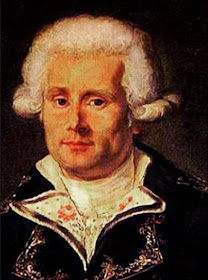
Louis Antoine de Bougainville
The first Westerners to set foot there are the Dutch Willem Schouten and Jacob Le Maire, who discover Futuna, May 22, 1616.

Wallis Island was only discovered 150 years later by the British Samuel Wallis, whose it bears name.

The first French to land was Louis Antoine de Bougainville, 11 May 1768.

The Bay of Leava, on Futuna
Yet it was not until the establishment of Catholic missionaries in the nineteenth century to see in the archipelago a significant European presence.

It was until 1887, at the request of Queen Amelia, that the kingdoms of Uvea in Wallis, Alo and Sigave in Futuna sign a protectorate treaty with France.

Finally, it was in 1961 that the archipelago became an Oversea Territory (TOM).

One wealth: nature
Wallis and Futuna are quite poor islands, mainly because of their dangerous access and a severe shortage of fresh water. It’s for this reason that some islands (as Alofi) remain uninhabited.

Poi, the capital of the kingdom of Futuna
These features allow only a rural economy, focused on artisanal lagoon fishing and subsistence farming.

In this very poor population, 70% don’t have access to the cash economy. And on the 2 000 jobs in the archipelago, 1 100 are civil service positions.

Some resources result from flags of complacency and flat annual tax on offshore companies with no activity on the territory of Wallis and Futuna. These resources should quickly disappear due to European regulations in the context of the fight against money laundering.

The three kings of the French Republic
If the archipelago of Wallis and Futuna is a French territory, and as such subject to the rules of the French Constitution, it has very specific institutions.

Thus, if the government of the Republic is concentrated in the person of the Senior Administrator, the archipelago is divided into three traditional monarchies: the kingdoms of Uvea (on Wallis), Alo and Sigave (on Futuna).

The three monarchs, with elected councilors and representatives of the State, govern the archipelago.

Kapeliele Faupala, the new king of Wallis
Warning, these are not hereditary but aristocratic monarchies: they are the noble families, Aliki, who elect or destitute kings.

Customary power is important but decentralized: on the side of the anvil, the kings must negotiate with village leaders and fund the demands of the Aliki who elect them and whose moral authority is based on population. On the side of the hammer, they must also negotiate with the representative of the State for obtain the development budgets of the territory.

To cover their costs, the Kings have an annual budget of the Republic which also compensates royal ministers and chiefs of districts and villages.

Thus, to have guillotined its last king, the French Republic remains committed to a certain idea of monarchy.

A feast in a school of Wallis
Moreover, the monarchical system of Wallis and Futuna don’t seem so crazy: between an elected king and a president of the Fifth Republic with virtually absolute powers, even is there a big difference?

An article of Julien Gué
Translated from French by Monak


Copyright Julien Gué. Ask for the author’s agreement before any reproduction of the text or the images on Internet or traditional press.